|
Copyrighted by SafariEgypt.com
All rights reserved!
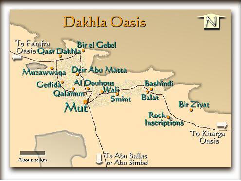
All maps, graphics and original descriptions created
by SafariEgypt.com, unless otherwise noted and/or directly
linked to the source, and use of same for any application
whatsoever (with the exception of outline maps) requires
written permission.
We make no copyright claim on any statistical data on this
page, nor on any non-original graphics, and/or pictures
not produced by us. Certain statistical data is gathered
from the locally published maps (authorized and authenticated
by the ministry of Tourism), Google Earth, Google Maps,
CIA World Fact book, as well as numerous public domain reference
materials.
Every effort is made to be as accurate as possible when
disseminating information on any Egyptian destination. We
are not responsible for unintentional data entry errors
or omissions. If you would like to submit an addition, change
or correction, or suggest a new link, please forward it
to our map department (maps@safariegypt.com) and we will
give it our immediate attention.
|